In which I take N1QDQ international as N1QDQ/VE2 in eastern Quebec
Over the past 15 years I have made many trips into eastern Canada, and most of those trips have focused on the Gaspe Peninsula. It is a lightly populated region with amazing culture, friendly people, great food, and stunning natural beauty. The peninsula is bounded by the St. Lawrence River on the north coast, the Baie des Chaleurs on the south coast, and the Gulf of St. Lawrence at the eastern end. The region is heavily francophone, and their dialect can be tough to understand even for other Quebecois. For me with my limited vocabulary, tin ear, and brutal American accent it is pretty much impossible. But on the other hand most Gaspesians will use whatever English they have to stop me from assaulting their language. When it comes to road signs, menus, basic written French… I can get by comfortably.
As a satellite radio operator the attraction of the Gaspe is how few stations have contacted the region. Hams use a geographic system called the Maidenhead Grid Locator which organizes the planet by grids 2-degrees wide and 1-degree tall. In Rhode Island the whole state is in a Grid called FN41. The next grid square north is FN42, and the grid square to the east is FN51. Here’s an example:
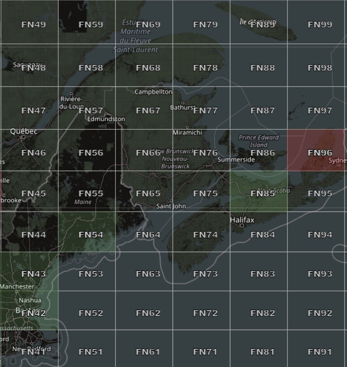
Hams collect contacts with these grid squares in a philately-like quest. Some grid squares are lousy with satellite operators. Even one or two active operators can make enough contacts to make that grid square commonplace. Other regions, and the Gaspe certainly fits this bill, have no operators at all. If you want a contact with that grid square then someone has to go there and “activate” it. That activity is called “roving”, and it is similar to the portable VHF contest activity I have done previously (also called a Rover station).
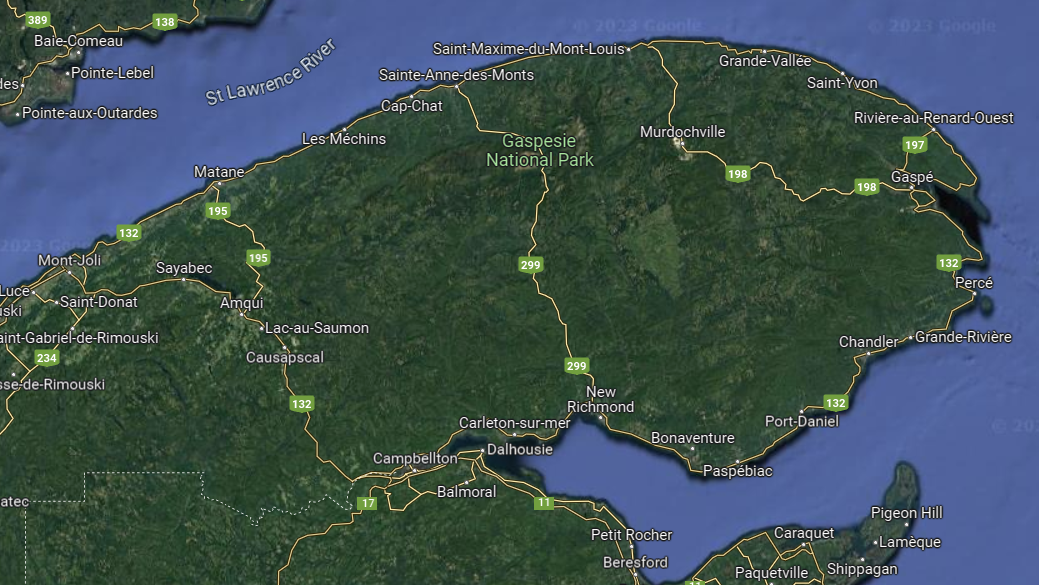
With all of the travel restrictions over the COVID era I have not been there since the fall of 2019. My good friend Philippe lives there and we have both missed our time visiting either here in New England or there in Quebec. This put two trips I wanted to take in play as one single trip. A satellite rove to the Gaspe and time to spend with good friends in a great region of the world. Matane, Quebec is about 750 miles and 11-12 hours from my home in southern Rhode Island. My preferred route is to avoid Boston traffic and drive straight up US Interstate 91 through Connecticut, Massachusetts and Vermont, then to Drummondville, QC where the Trans-Canada Route 20 takes me 7 hours east to the Gaspe. The first goal is to get past Springfield, MA where the traffic calms down and the drive up the scenic Connecticut River Valley begins. Once across the Canadian border the terrain flattens and the English-speaking FM radio stations fade into the distance. Turning east at Drummondville, QC puts me on a not too pretty stretch of road that changes dramatically once I have passed Quebec City. From there it is a parkway through rolling farms, the St. Lawrence River, with the last gasp of the Appalachian Range ahead.
With all that preamble done, here is the radio stuff you probably came here for:
The Plan:
I brought equipment to work both Low Earth Orbit (LEO) satellites and the Greencube/IO-117 Mid Earth Orbit (MEO) digipeater satellite. The LEO rig is a Yaesu FT-817ND for the uplink and an ICOM IC-705 for the downlink. I use Micro-circuits filters on both antenna feeds, and an Arrow II dual band antenna. It is powered by a homebrew LiFePO4 battery pack and is easy to take on a short walk or easy hike. The main satellites I was interested in were RS-44, AO-7, SO-50, and the ISS.

My MEO setup is not so portable. My newly acquired ICOM IC-9700, a 20Ah Bioenno LiFePO4 battery, my Dell Ultrabook, a WIMO 435MHz X-Quad, and a very brawny and old Gitzo photo tripod.

These trips are easiest for me if I get a very early start, and on this trip it was wheels-up at 5:00AM. Once I made it to White River Junction, VT I stopped for a break and checked the satellite schedule. I saw a decent RS-44 opportunity at about 9:30 AM EST / 1330 UTC. Here is a good example of the challenge a big trip like this posed to me: How much time am I burning to work a satellite pass when it is part of a 12-hour drive? When I saw a pass that had good elevation, or was in part of the sky I expected to see clearly, the plan was to look for a spot starting about 10 minutes before AOS. I would simply keep driving if I ended up in some gorge, or blocked off by a mountain range.
First Stop: RS-44 from FN34wa near Norwich, Vermont.
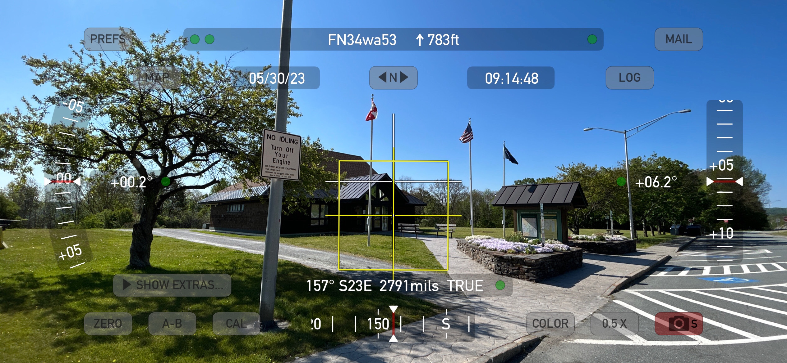
This is a roadside rest area and while it wasn’t amazing the pass was high enough to clear the short ridge to the west. I made 11 contacts and the site was fairly quiet. I was concerned about how much RF noise I would encounter at an interstate roadside. This one wasn’t bad even with traffic on the highway and the tractor-trailer that pulled in a parked right in front of me. Of course I was in rural Vermont and not on I-95 in the RF hellscape of Fairfield County, CT.
Second Stop: IO-117/Greencube from FN45al near Sherbrooke, QC.

There is a grid intersection in Sherbrooke where the Rt. 55 briefly loops from FN35 into FN45, but none of the gridline locations looked safe. I pulled off an exit and found a safe roadside spot in FN45 with a good view of the pass. It was also near the entrance to some kind of gravel/crusher operation because dump trucks full of that stuff kept rolling past. It was hot, dusty, and dry. But, I did put another 11 contacts into the log.
Here’s my Greencube rant: I could have made many more contacts if it weren’t for the “ham radio stylings” of several operators. On a digipeater you are trying to get the sat to hear you, the retransmit your message. It is simplex, meaning it alternately receives or transmits on a single frequency. If you see your message come back then most of the other operators also saw your message. Job done. Or it should be. Several of the stations that kept calling me multiple times within each minute were taking the slots I needed to reply. Having one station doing that makes it hard to reply, and a few stations doing that made it impossible. These same stations were calling me, and THEN calling CQ in the next frame! EVERYONE SAW YOUR CALL. Why ask for more congestion when you are trying to make a contact? Also, the pass put the bird over Europe for the last half. These big-gun Europe and Russia stations have the sat at a very high elevation. I’m on a roadside running 25W off a battery and manually trying to keep the antenna pointed at the bird as it is at 20 degrees elevation and descending. My range to the satellite is at least twice what theirs is. And they keep big-footing the digipeater. I won’t go on, but I will say this about Greencube: Less Calling Equals More Contacts.
As much as some ops have turned this bird into a cesspool of terrible operating practices, ahem, I was looking forward to using the huge footprint to contact hams in Japan, and South America, and the Middle East… Sadly there was a technical problem and Greencube stopped operating its digipeater just after this stop. It was inactive throughout my entire trip and would not be active until one week after my return. Good Grief.
Stop #3: RS-44 from FN58oi, Le Bic, Quebec.
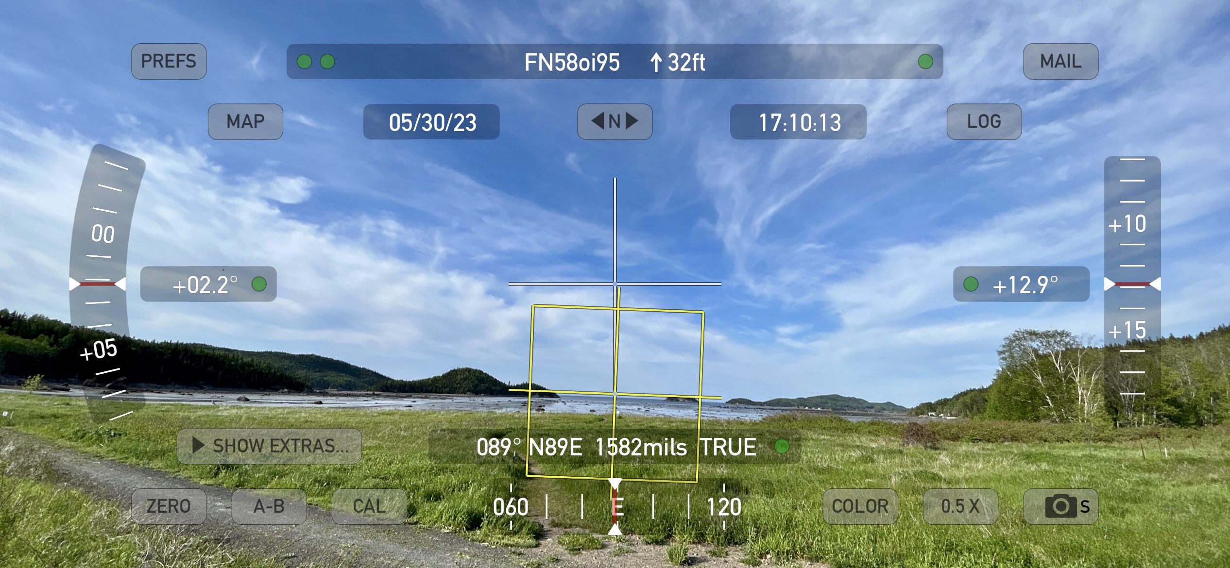
In this case there was an eastern pass of RS-44 and I was passing one of the few stretches of the road where hills block the north and east. It looked like I might have to skip it but I was pretty sure the entrance to the SEPAQ park in Bic might have a view across the bay to the east/northeast. The question was if I would get there in time. I did, and it did. Again, 11 contacts! It had some power line QRM and the southeast part of the pass was blocked off by hills. After this is was time to pack up and finish the drive to Matane.
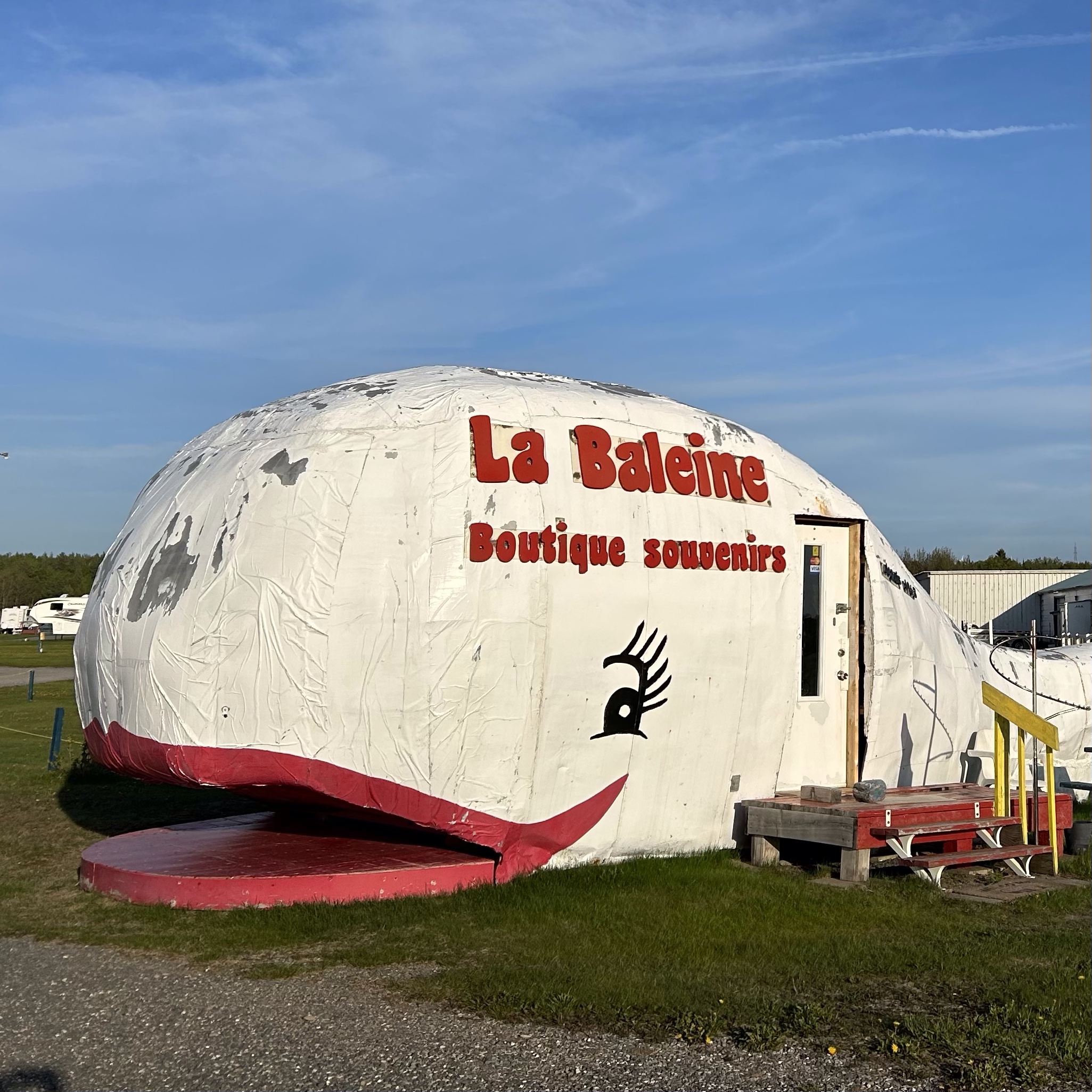
I consider Matane the gateway between the Bas Saint Laurent (Lower St. Lawrence) region and the Gaspe-Peninsula proper. My perception is mostly about geography. Matane is the first of a long string of towns which sprung up where a river meets the sea. These were natural places for fishing, logging, transportation, and general commerce. The Matane river is a major salmon fishing destination and tourism hub, but is also a sleepy town with a few hotels and a nice centerville. Even if you just stop at La Fabrique microbrewery and gastropub it is worth it, but definitely take a walk by the river and see the port area.
On my first day I experienced a trademark weather switcheroo. We went for an early afternoon hike in the interior above Rimouski and had at least 90F/35C and full sun. As soon as we headed back to the coast the view over the St. Lawrence River greeted us with a line of storms coming straight across from the north. Within hours the temperatures had dropped into the low 40F range and were still dropping. That weather even set the stage for a cold and wet visit.

In Matane I scouted out an elevated spot above the Old Harbor which was good for seeing that big north horizon. The cold wind was a challenge which would continue for the most active part of the trip. This location in FN68 was my most productive as it was less than 10 minutes from the apartment and had parking spaces and a picnic table. Sometimes you take the easy spot and run with it. This was one of those times.

With Greencube out of the picture I focused on RS-44, and looked out for AO-7 and ISS passes. The Matane stop was a good chance to recharge from the drive, and with the weather turning bad I wasn’t as active as I planned to be. Even with that I was sticking to my goal to move up the coast and activate FN69, FN79, and FN78. That drive just happens to be one of the most dramatic tours in Quebec. Even with the bad weather it was going to be a good drive.
Finding public spots to make satellite contacts on the coastline can be a challenge as the road does not have many safe pull offs. With the SW-NE angle of the coastline it can be tough to find a clean look to the E-SE and SW looks are even rarer. Many of the passes I worked were partials. I could see the first half or the last half of the pass, but not both. Better than nothing! Narrowing down potential passes was straightforward. I looked for good direction, good/workable elevation, and good timing.
Early the next morning I headed out to work two RS-44 passes in Matane, returning to warm up between passes. Then it was time to pack the car and start the trip to Riviere au Renard on the eastern tip of the Gaspe.


I have been close but never actually visited Riviere au Renard before so all I had to go on was Google Earth and some photos from the web. I was excited to operate from here because the FN78/79 grid intersection runs right through the fishing port, and Google Earth made it look like the parking lot at the Auberge Caribou was on the gridline. I’d be having a comfortable activation and noshing on a chicken wing before sliding into my warm bed! Or so I thought.
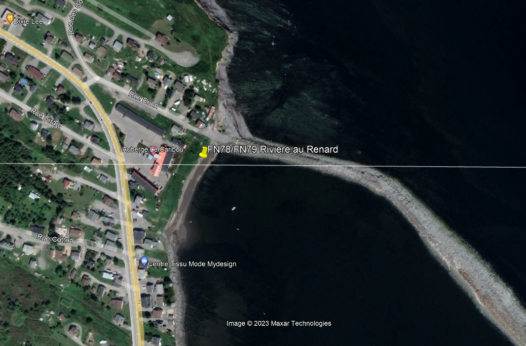
This was a LIE! The Maidenhead overlay I use in Google Earth is deeply flawed. While it shows the gridline in an easy spot it turned out to be slightly south of here. This miscue is also on me because the Lat/Long display in GE actually shows me that this displayed line is slightly north of the true line. NEVER TAKE EASY INFO AT FACE VALUE.
The actual Gridline is HERE:

Here’s the thing: I am very sensitive to property issues and avoid trespassing whenever I can. While wearing headphones, carrying two radios in a sling bag, and pointing an antenna, I’m even more sensitive. You never know what kind of reaction you will get from a homeowner even if you aren’t on their property (or are you?). The beach on the east side of the 132 is where I should have gone. BUT, long drives in bad weather combined with a focus on where I thought the line should be gave me a kind of tunnel vision. I walked out onto the seawall and kept going until I hit the gridline. This was stupid. I have spent a lifetime rock hopping on seawalls here in southern New England. It’s not like I had no idea what I was doing. But, this thing was a beast. It had much more in common (difficulty wise) with an alpine scree slope than a Rhode Island “breachway”.
But I did it.

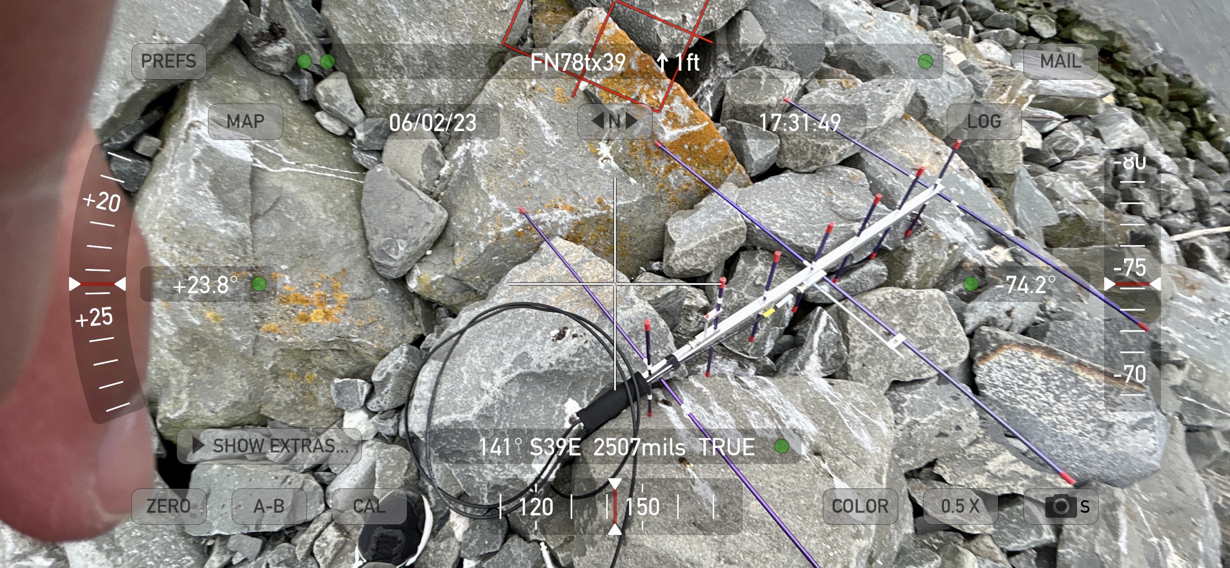
I even missed the first part of the RS-44 pass while I slowly made progress until my iPhone GPS showed both FN79 and FN78. I finally got to the spot and I made a few RS-44 contacts. Then I saw an overhead ISS pass was starting right after RS-44. I’m there already. I’m cold. I’m wet. But I’m there. Why not! I’m so fried that even an FM sat looks like an oasis!
And that’s when I worked astronaut @Astro_Woody Hoburg, operating as NA1SS on the International Space Station. To say it was surreal is an understatement. I was wet and freezing and trying my hardest to dodge the big splotches of seagull excrement that surrounded me. And then I’m talking to an astronaut. And then I’m not. And then I have to retrace my steps back to the shore. That is where the satellite portion of the evening ended. The next RS-44 pass was not going to happen. I needed to shower, eat, sleep…
By the way, Au Frontibus microbrewery is the hot setup in Riviere au Renard. Relaxing, hot fresh food, and good beverages no matter your tastes. Even the soda selection is very good. Auberge Caribou was a good place to stay but I’d skip the restaurant. There aren’t many choices, but Frontibus turned out to be a better option.
The next morning I had recovered enough and was still waking up very early. That happens to me on some trips, especially with an itinerary. At 0520 local I worked an RS-44 pass from the beach in front of the hotel in FN79. It was back to the hotel room to organize my gear and prepare for load-out. About 90 minutes later I made my way over to the port and worked the next RS-44 pass from a dock in the fishing port in FN78. That’s more like it. No ankle-breakers and bird bombs. The weather was still foul, I was still very cold and exhausted, but at least I wasn’t slipping on seagull poo.
A hot breakfast at the Croque-Faim restaurant, a hot-ish shower, and I was ready to hit the road back to Matane. I think the return trip is somehow even more dramatic than the trip out there. There are sections where you crest a rise in the road and the view is literally breathtaking. The massive St. Lawrence spreading out to the horizon, a tiny church spire on the shore below.

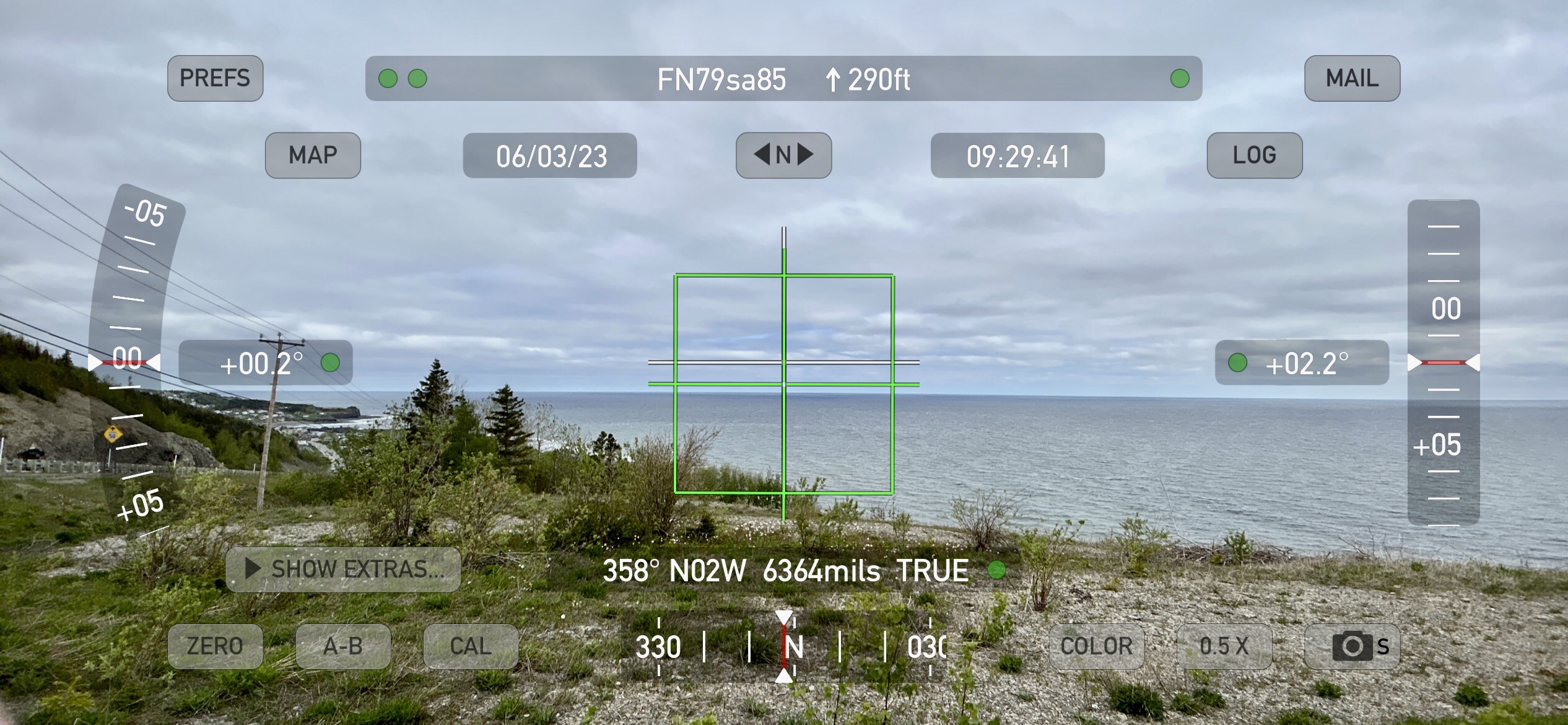
Just west of Riviere au Renard is a small one of these crests, and there is a safe pull-off on the north side of the road. I used that spot for several passes, with its open view to the west and north. The photo below shows north but I think it is actually a but more west. The compass in my iPhone was unreliable in many spots. I’ve seen this at Ninigret Park in Rhode Island, an ex military air base with who knows how much ferrous and copper buried beneath the surface. For whatever reason I had a devil of a time getting compass bearings and resorted to maps with fixed north if I had cellular data available.
An early pass there was nice and quiet, but the pass I worked on my way out of town was a mess of wall to wall white noise. I am pretty sure someone was welding nearby. It wasn’t crackly or fluctuating. It was just +20 white noise, then off, then on, then off… Just like someone laying down beads with a MIG welder. I still made contacts, and I took the approach of transmitting during the noise. I don’t need to hear myself and it increased the odds of a reply happening during an “off” period.
One very cool characteristic of the Gaspe is the lack of RF interference. In most areas you will hear four FM stations at most, and the cellular comms density is very low. In an area where I would be deafened by broadband noise, solar inverters, bad lighting transformers, etc… it was some of the quietest VHF/UHF conditions I have operated in.
The run back to Matane was still cold, but the sun came out and the Saturday traffic was light. It took me half the time to get back as it took to get out there on a wet Friday.
In the end I made 157 QSOs to 16 countries, contacted 82 separate grids, and activated seven grids (FN34, 45, 58, 68, 69, 78 and 79). This was my first rove and it was a trial by fire. My VHF contesting experience came in handy when managing the pileups and scouting for clear operating locations. The added logistics of finding appropriate pass times and trying to get to the right location at the right time were more difficult. On my outbound trip to Riviere au Renard it took over five hours. My Time-Speed-Distance (TSD) approach was down the drain. The return took three hours. Same deal. It’s either operate on the move, or hunker down. Doing both is a lot to manage.
Another major factor on a long trip like this is fatigue management. My trip from RI to Matane was 14 hours, and about 750 miles, including the three stops for satellite work. That requires some recovery time. I don’t want to have an accident or make a bad decision because I am exhausted. I was also there to visit a friend, so satellite passes were secondary at various times.

My return to Rhode Island was an uneventful 12 hours on the road, carrying many great memories and knowing that I have to be OK with how everything worked out. A major satellite in my plan conked out. I was not as fresh as I thought I would be and the cold and wet really took some of the energy out of me. My take-away is that I could have spread out stays over more locations and felt less exhausted and less rushed. But I also know I had a great time and found some kind of balance between satellites, rest and relaxation, and driving. I hope to be back there in a few months and will at least have my LEO setup with me. I hope it happens and I hope to get more of these grids into the logbooks of my fellow satellite operators.
Acknowledgements:
I’d like to thank everyone who supported me with education, information, kind words, and encouragement. John VE1CWJ, Ian K5ZM, John KG4AKV, and Jerry W8LR were huge sources of support as I prepared to leave on this trip. Carsten OZ9AAR, Peter G0ABI, and Peter 2M0SQL were reliable voices as I did my best to activate these grids. The Ham Twitter community at large was massively supportive and I couldn’t have done it without them. Considering that I started working satellites in October 2022 it was a steep learning curve and many hams were there with patience and great information. 73
